Kinu Tourism Project Indigenous Tourism Resources
The Mi’kma’ki Map
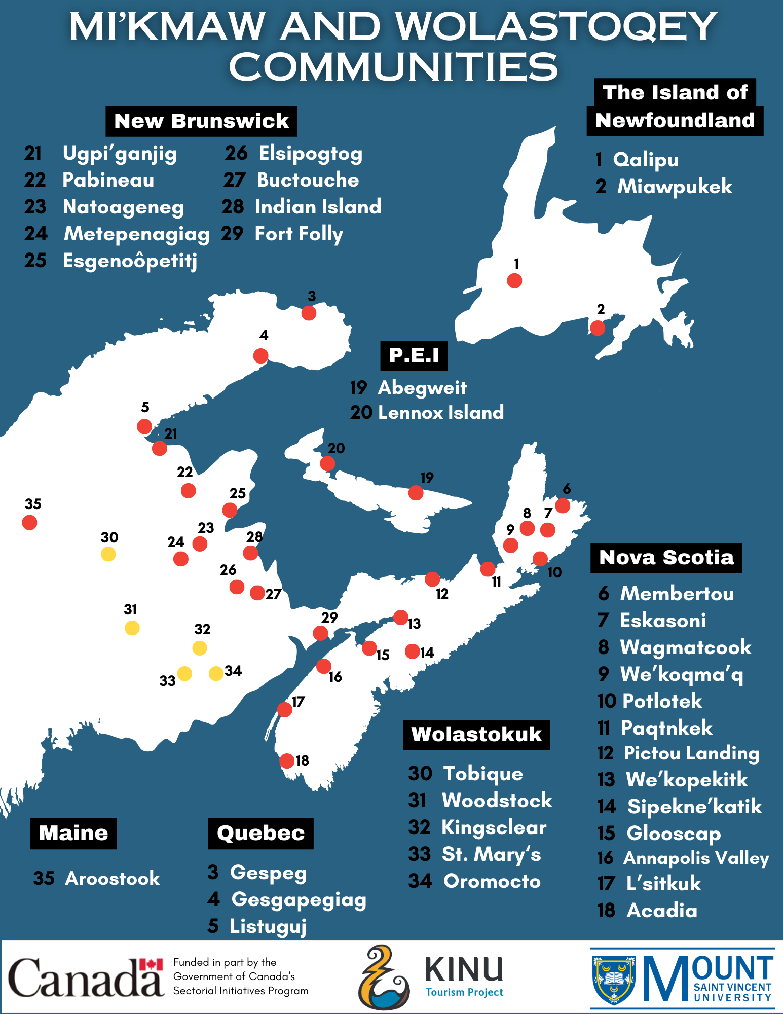
This map was created by the Kinu Tourism Project and the Kinu Mi’kma’ki Advisory. It is a visual representation of the Indigenous communities that reside in Mi’kma’ki, and includes the names for each Mi’kmaw (red circles) and Wolastoqey (yellow circles) communities. The Mi’kmaw communities are depicted by the red circles and Wolastoqey communities are shown by the yellow squares.
Through our research and the supportive assistance and guidance from our Kinu Mi’kma’ki Advisory Committee, the Kinu Tourism Project has been able to create this educational tool and obtain the traditional names for these communities and traditional districts of Mi’kma’ki. Some of these communities are written in their traditional languages, while others are written in their colonial name. Recently, more of these communities are becoming recognized by their traditional Indigenous names.
This is a working document and will continue to be improved upon regularly. We work diligently to ensure proper name and location of each tribal community and continue to work with community leaders, elders and knowledge holders so that our work is supported authentically.
The Research Report
Charting a Course Kinu (Together)
Identifying Facilitators and Barriers to Participation of Indigenous Students in Post-Secondary Tourism Education Programs in Atlantic Canada (PDF)